


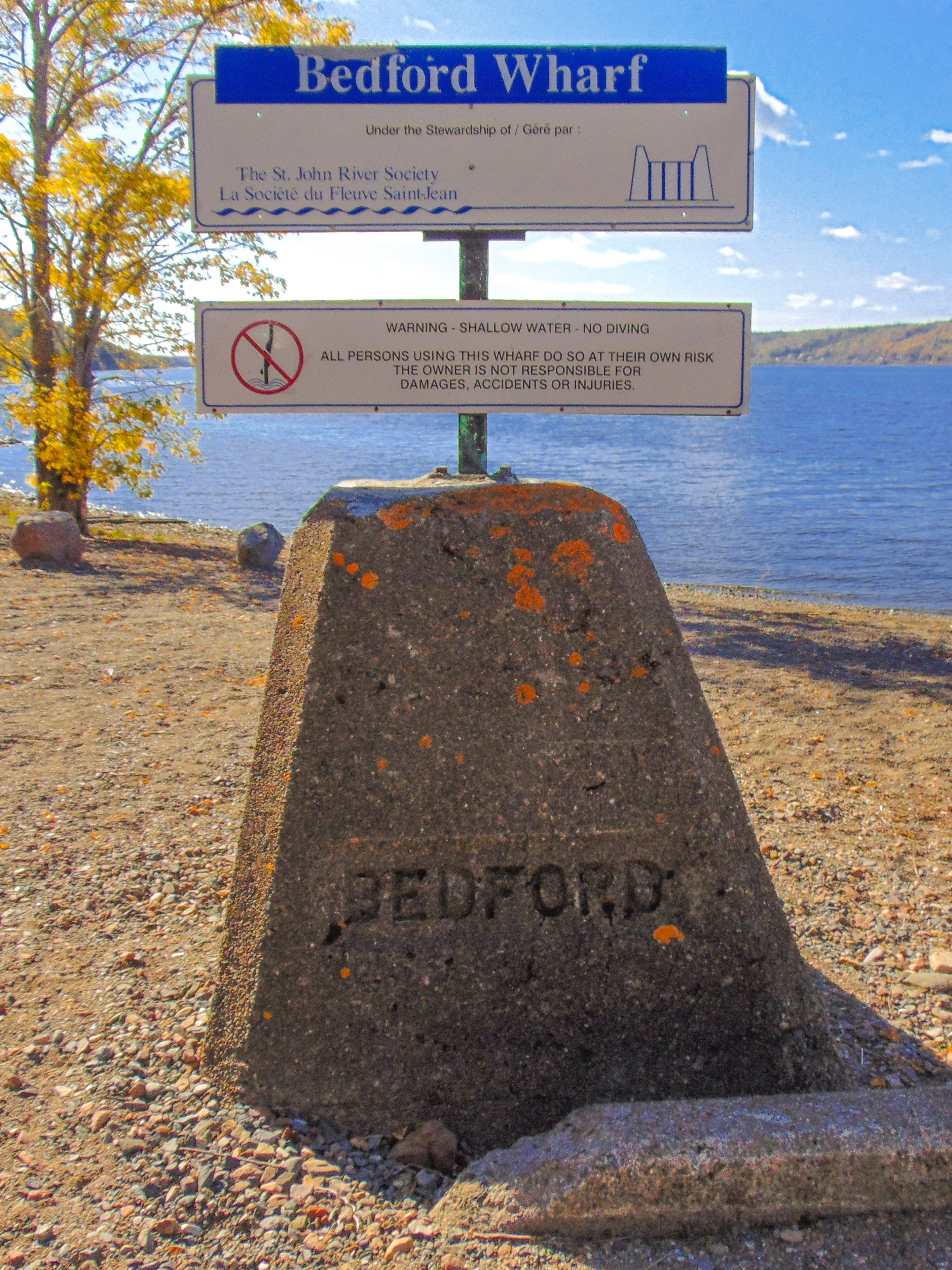
Bedford Wharf
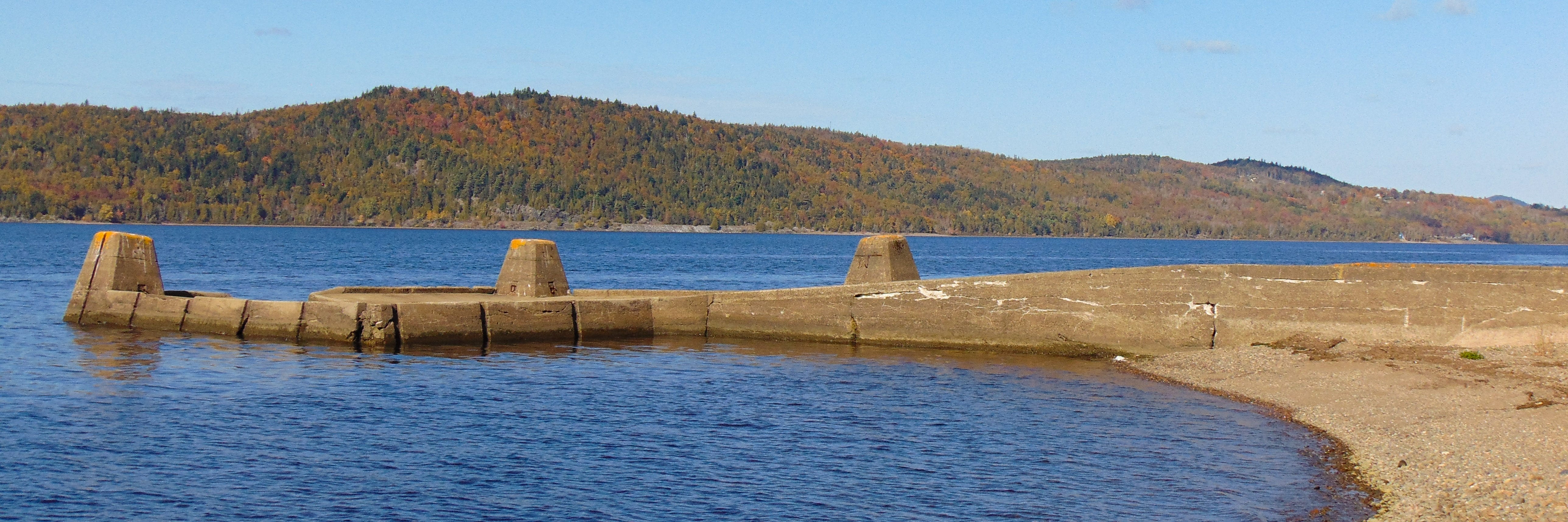
The Bedford Wharf is an L-shaped low water wharf on the Long Reach of the Lower Wolastoq in the Fundy Rural District.

This week’s wharf profile is the fourth in a series of collaborations with the St. John River Society. Initially acquired when the Department of Fisheries and Ocean’s Small Craft Harbour Program began divesting itself of derelict, low activity, and/or recreational wharves in the late 1990s, the St. John River Society took ownership of thirteen steamboat wharves to maintain public access to the river. The Society’s public wharves are undergoing major repairs this summer through a $970,000 grant from the Canada Community-Building Fund.1 Subscribe for free to receive future profiles directly in your inbox or check out the archived wharf profiles on previous Society wharves like Gerow’s, Hampstead, and Public Landing.
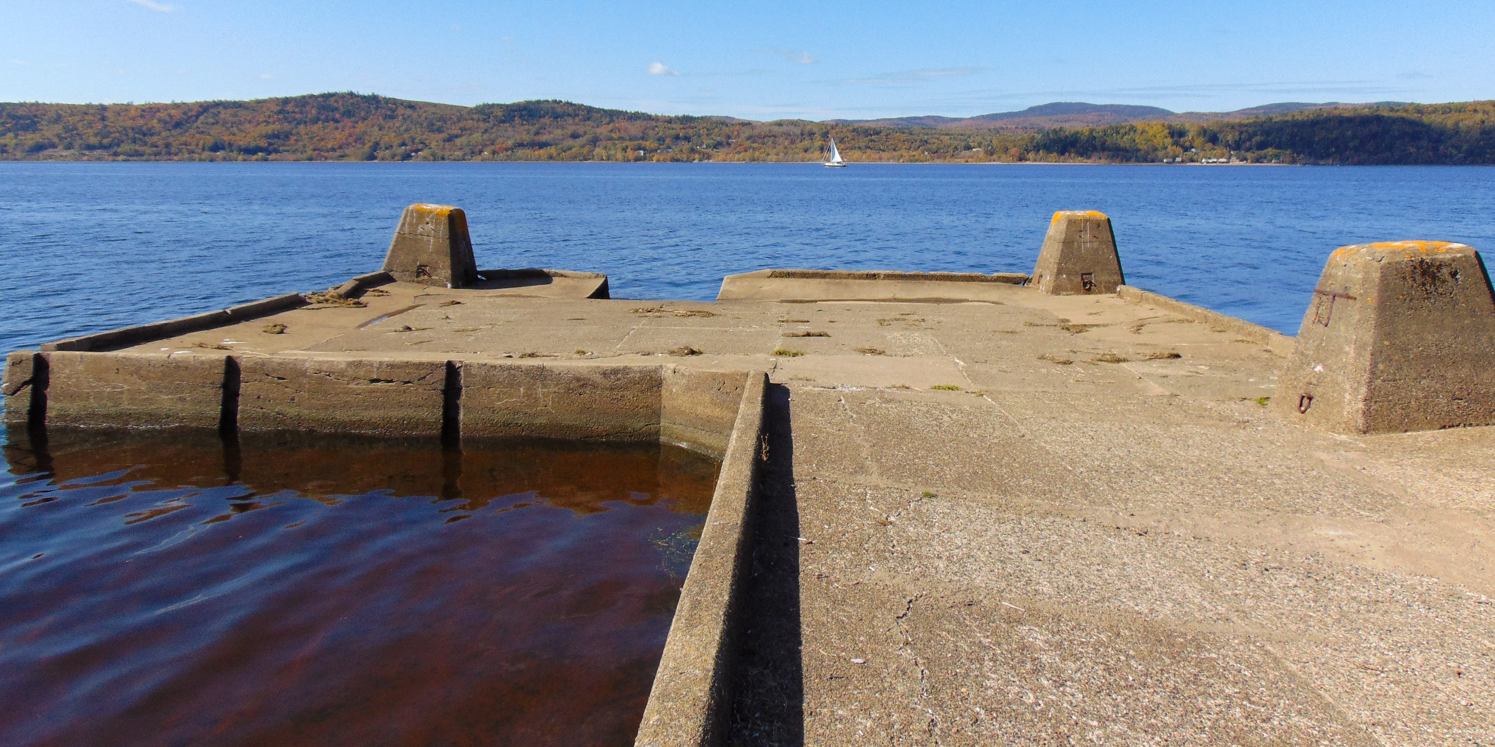
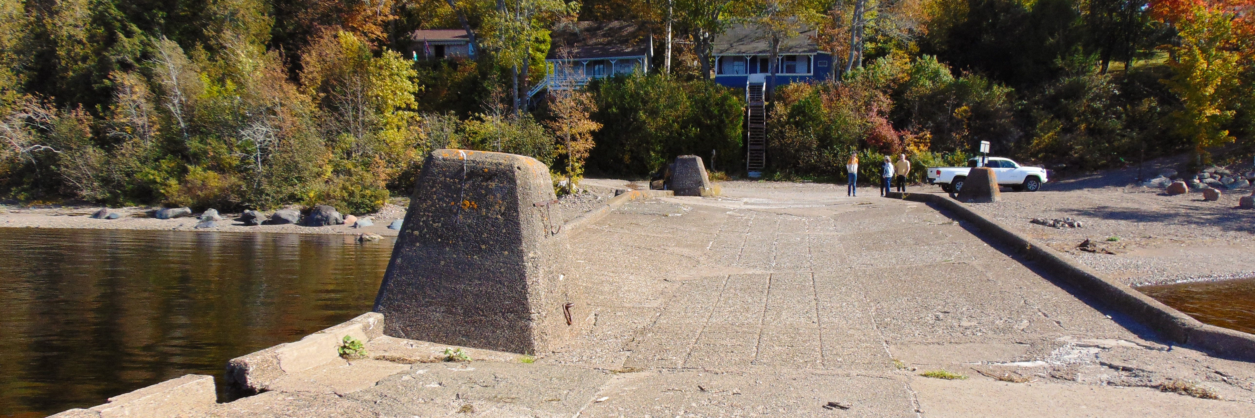
Bedford Wharf is an L-shaped low water wharf. The main deck is somewhat graded, with three inset piers along the upriver wall. The L-end extends downriver and features two corner piers and a cargo slip. Unlike most of the wharves profiled in previous weeks, Bedford has no small craft access stair. However, it does feature fender grooves along the inner wall of the L-end, indicating that the berth was intended to be used by small craft.
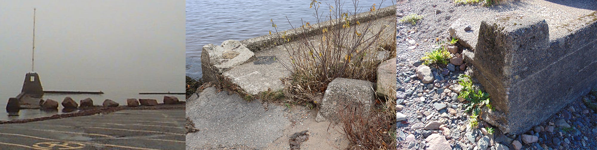
When I say there are three piers along the upriver wall, that count admittedly requires a bit of an asterisk. Visitors to the wharf today will note the peculiar placement of the decorative pier on the shore that features the engraved name and date of construction. This pier has been relocated from its original position along the upriver wall, having broken off at point I’ve not yet managed to pin down.
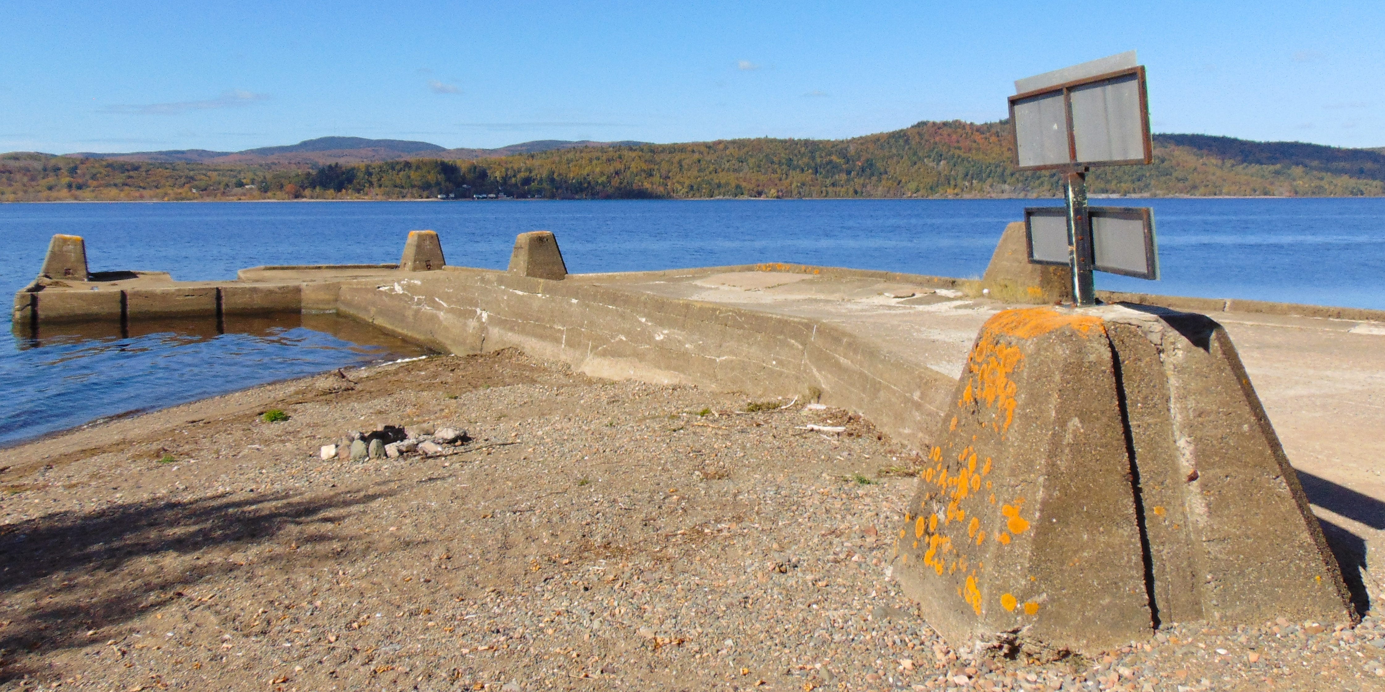
Even with the vacancy left by this pier, there are still technically three piers along the upriver wall. Although incapable of fulfilling any of the functions of a regular pier because of its diminutive stature, there is also a miniature pier at the shoreline. This mini-pier is now unique on the river since the only other example at Westfield was dislodged in a freshet sometime after 2009.2 The purpose of these mini-piers is unclear to me, but they’re certainly cute.
The Bedford Wharf was built in 1901 for $689.50.3 The wharf required consistent repairs throughout the first 13 years of its existence. Both 1901 and 1902 were reported to be disastrous freshet years,4 requiring substantial repairs immediately after initial work began and minor repairs continued in 1904, 1907, 1908, 1909, 1910, and 1913.5
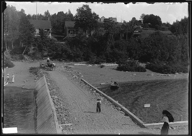
This original iteration of the wharf had a similar layout to today’s with a few notable differences. Although still L-shaped, the main deck and approach were not graded. The wharf also featured no piers along the upriver wall. Instead, a pitched ice guard was installed to guard against freshet damage. The photos I’ve seen have not shown the wharf face so it is unclear whether mooring posts or piers were present on the wharf face at this time.
Archival photos also show how the wharf’s name was displayed prior to being upgraded with concrete in 1931. Regardless of whether the original Bedford Wharf featured corner piers, the Lower Wolastoq’s wooden wharves did not have their names carved into piers. Instead, little white plaques mounted on poles displayed the community’s name. I cannot imagine that these signs fared well in annual freshets.

Until 1908, the Bedford Wharf was often referred to as the Holderville Wharf. The Holders were a well-known shipbuilding family on the Long Reach and the cottage community around the wharf still bears their name.6 Notably, the reports for 1901 to 1907 refer only to the Holderville Wharf, with 1908 including separate charges for both the Holderville and Bedford Wharves. Although it’s possible that there was a separate Holderville Wharf in the early 1900s, it is more likely that both names refer to the same structure and the inclusion of separate charges for both wharves in 1908 is an accounting error. From 1908 onward, all records refer exclusively to Bedford with no further mentions of Holderville.
That being said, other records indicate that there was a boat stop on the steamers’ route known as Theodore Holder’s even after the name Bedford was solidified. A more detailed explanation of the distinction between boat stops and wharf stops warrants a dedicated blog post, but in brief, the steamers made two kinds stops on their route: As the name suggests, wharf stops involved stopping the ship at a formal structure. Boat stops were more complicated and involved passengers and goods being rowed out into the middle of the river by a landing keeper to rendezvous with a passing steamer.7 Although Captain Donald Taylor includes Theodore Holder’s among a list of prominent wharf stop along his route,8 other sources make reference to local farmer Theodore Holder personally rowing out to meet the steamers,9 which seems to indicate that Holder’s was a boat stop distinct from Holderville.
Today the Bedford Wharf is maintained by the St. John River Society. Beyond some bowing in the deck, the wharf is in good repair and therefore is not slated to receive contractors’ attention this season. Although there is no boat launch attached to the wharf, there are other tantalizing amenities: a beautiful sandy beach has accumulated in the wharf’s berth and the wharf is only a short walk away from Yip Cider.
Jeanne Armstrong, “A century ago, river wharfs were a lifeline for residents. Now they’re getting a facelift,” CBC News, July 24, 2024, https://www.cbc.ca/news/canada/new-brunswick/saint-john-river-wharfs-facelift-1.7272506.
Notably, the top of the pier is still present at the site and, were public interest to incentivize it, it could be re-attached and repaired.
Forty-Seventh Annual Report of the Chief Commissioner of Public Works, New Brunswick 1901 in Journal of the House of Assembly of the Province of New Brunswick (Fredericton, New Brunswick: L.B. Williams, 1902), 20.
NB Public Works 1901, 9. Forty-Eighth Annual Report of the Chief Commissioner of Public Works, New Brunswick 1902 in Journal of the House of Assembly of the Province of New Brunswick (Fredericton, New Brunswick: [Printer information obscured in scan from Legislative Library], 1903), 9.
Fiftieth Annual Report of the Chief Commissioner of Public Works, New Brunswick 1904 in Journal of the House of Assembly of the Province of New Brunswick (Fredericton, New Brunswick: Anslow Bros., 1905), 36; Fifty-Third Annual Report of the Chief Commissioner of Public Works, New Brunswick 1907 in Journal of the House of Assembly of the Province of New Brunswick (Fredericton, New Brunswick: [Printer information obscured], 1907), 54; Fifty-Fourth Annual Report of the Chief Commissioner of Public Works, New Brunswick 1908 in Journal of the House of Assembly of the Province of New Brunswick (Fredericton, New Brunswick: [Printer information obscured], 1909), 47; Fifty-Fifth Annual Report of the Chief Commissioner of Public Works, New Brunswick 1909 in Journal of the House of Assembly of the Province of New Brunswick (Fredericton, New Brunswick: [Printer information obscured], 1910), 89; Fifty-Sixth Annual Report of the Chief Commissioner of Public Works, New Brunswick 1910 in Journal of the House of Assembly of the Province of New Brunswick (Fredericton, New Brunswick: [Printer information obscured], 1911), 26; Fifty-Ninth Annual Report of the Chief Commissioner of Public Works, New Brunswick 1913 in Journal of the House of Assembly of the Province of New Brunswick (Fredericton, New Brunswick: [Printer information obscured], 1914), 26.
Doris Calder, All Our Born Days, A Lively History of New Brunswick’s Kingston Peninsula (Sackville, New Brunswick: Percheron Press, 1984), 105.
Donald F. Taylor, From the Splash of the Paddle-Wheel: True Tales of the Steamboat Era (St. Stephen, New Brunswick: Print N’ Press Limited, 1985), 12-13.
Taylor, From the Splash of the Paddle-Wheel, 38.
Calder, All Our Born Days, 150; Calder writes that even eight years after the construction of the Holderville Wharf, Theodore would still row out from the point himself loaded with produce. Seems like a lot of extra work to me, but maybe it’s just easier to transport produce over the water directly from your farm than it is to cart it over to the wharf for pick-up.
20 Aug 2024. Regarding the comment dealing with Bedford Wharf and Theodore Holder's 'River Stop': the distance via Route 845 from Holder's to Bedford is 5.8 km [3.6 mi] and then there is the 0.5 km road from 845 to the wharf site, which is a round trip of 12.6 km [7.83 mi]. There are several hills on the route, and the roads in the early 1900s would not have been very good, so it made better sense to have the 'River Stop' at Theodore's. Rowing out in a rowboat was a better way. Also, there were often Long Reach folks who wanted to catch the boats to go either up-or-down river. If the weather was not great there was still the Bedford Wharf option. I have a few pictures of farmers and passengers at Theodore's waiting to meet the boat. A warning whistle blast was always given before the boats got to the designated stops. Gordon Miller, Holderville, NB