


Upper Jemseg Wharf

Upper Jemseg was a combined high and low water wharf on the Jemseg River, located in what is now the Village of Arcadia. It was demolished in the 1990s.
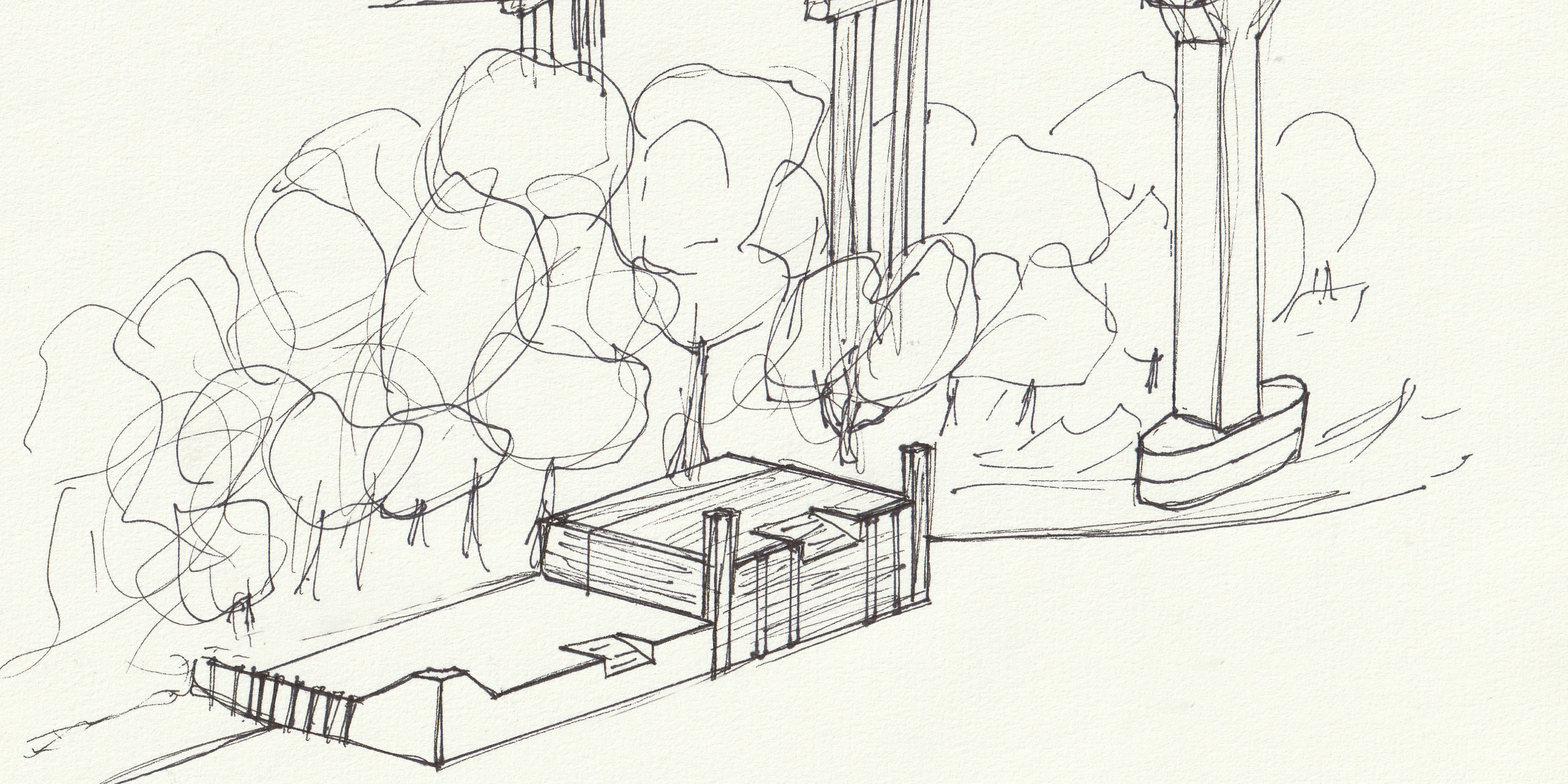
This week’s wharf profile is going to be somewhat different than previous entries. Last week I touched on the former high water wharf at Newcastle Creek as an aside, but this is the first time I will be profiling a wharf that has been entirely demolished. Since the Upper Jemseg Wharf no longer exists, there will be fewer visual aids than I typically include.
Despite the challenge this poses, I wanted to write about Upper Jemseg this week because the wharf was mentioned during a recent Roadside History segment on CBC Radio.1 The CBC’s story focuses primarily on the infrastructure that remains on site — namely the abutments of the original Jemseg bridge, the decommissioned highway bridge built in 1960, and the twin Jemseg River Bridges that currently support the TransCanada highway — but presenter James Upham also makes a brief reference to the wharf while discussing the area’s role as a hub for various other modes of transportation.2 I’d like to expand on this passing reference, insofar as that’s possible in the absence of physical evidence to draw on.
While it was intact, the Upper Jemseg Wharf was a combined high and low water structure, likely 36 meters wide and extending 19 meters from shore. I write likely in this case because the earliest written descriptions of the double wharf in government Sailing Directions provide no dimensions other than the depth of the water at the site.3 Later Sailing Directions specify that the low water section had an outer face 18 meters long,4 but by this point no dimensions are provided for the high water section because it was declared to be unusable with “[l]arge, sunken wood beams protrud[ing] beyond the visible face of these ruins”.5
The reason that the high water section degraded so rapidly in this period because it was never upgraded with concrete. Although easy to dismiss when visiting today because the remains of the wooden portions have deteriorated past the point of recognition, this kind of mixed-material high and low water split was quite common throughout the Lower Wolastoq in the twilight of the steamboat era. Many of the low water wharves around today such as Westfield, Evandale, and McGowan’s were originally conjoined with wooden high water wharves.
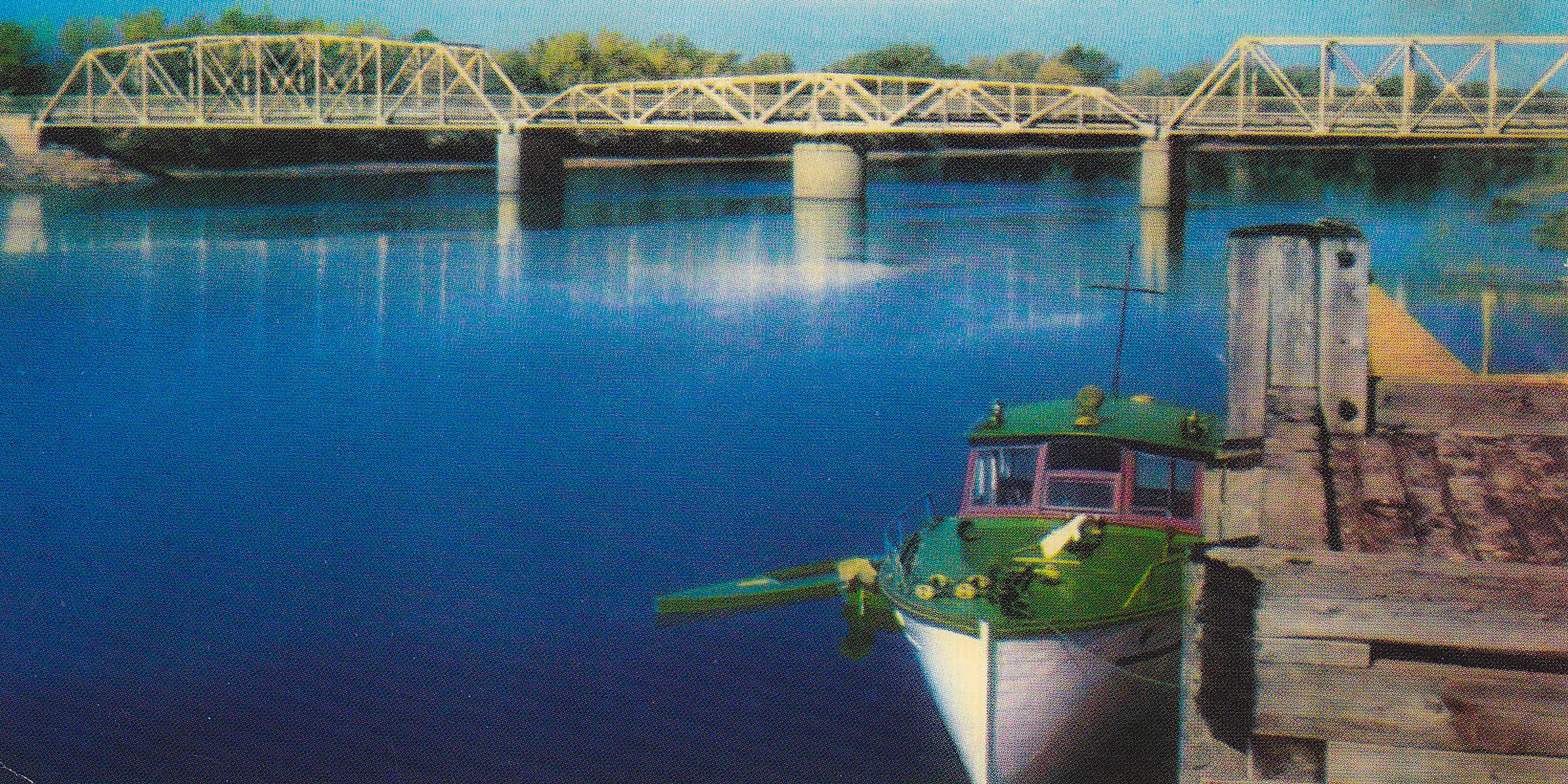
Other defining features of the low water section included an upriver corner bollard, a cargo slip, and fender strips and a small craft access stair along the upriver side.6 The high water section also appears to have had bollards on both the downriver and upriver corners, although they do not appear in more recent photographs.
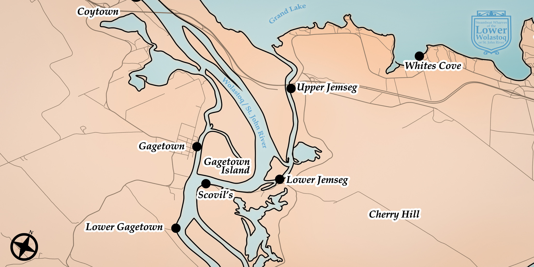
The Jemseg River connects Grand Lake to the rest of the Lower Wolastoq, entering the river through two channels east of Gagetown Island.7 There are reports of a wharf on the Jemseg as far back as 1881,8 but it is likely that these early entries refer to another wharf downriver at Lower Jemseg and that the Upper Jemseg Wharf was erected in 1905. Although federal and provincial Public Works Reports do not specify which “Jemseg Wharf” was constructed in 1905,9 concurrent reports of repairs to the Lower Jemseg Wharf indicate that it is both distinct from and older than the wharf at Upper Jemseg.10
The wharf was upgraded with concrete twenty years later in 1925-26,11 although other records indicate that another major refurbishment took place in 1939.12 The description of work provided in 1926 matches the overall dimensions of the wharf provided in other material but also describes features that do not appear in the limited photographic evidence available to me. The low water section is said to have two corner bollards, landing steps for small craft access, and a graded deck. It is possible that the renovations in 1939 totally overhauled the design of the low water section — I have not been able to track down a description of the work done in this year beyond the total cost of repairs — but it could also be the case that these features were retained but simply omitted from any and all photography.
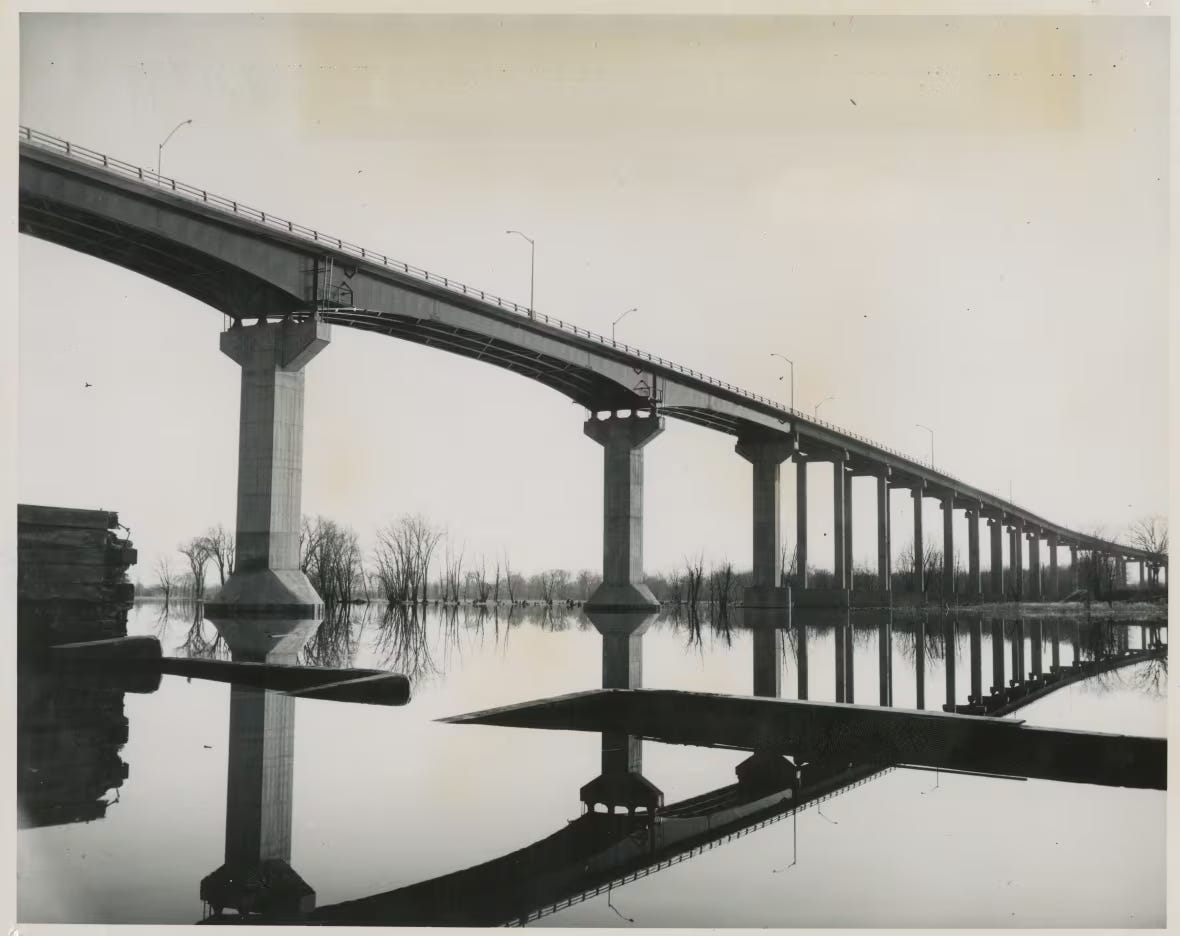
In 1980, decades after the end of steamboat service, the Upper Jemseg Wharf was repurposed as a marina and continued to serve that function until 1997.13 Although the wharf could have been purchased from the federal government for continued use when the Department of Fisheries and Ocean’s small craft harbour program began divesting ownership of the steamboat wharves under its control in the late 1990s, it appears that the wharf was ultimately demolished to facilitate the construction of a new section of the TransCanada highway.
The site of the Upper Jemseg Wharf is not beneath the footings of the bridges — it sat far closer to the footings of the now-decommissioned highway bridge — but it is likely that the structure was destroyed because it sat within the wider footprint area of the project. As Sue Blair and Ken Holyoke explain on an episode of the New Brunswick Archaeology Podcast — a program which I heartily recommend — the footprint area of the highway project was deliberately wider than the physical footings of the bridge to accommodate staging areas for equipment and design changes. Even if the wharf was not initially included in this footprint — which seems to be the case as the wharf was still listed as being available for purchase throughout the summer of 199814 — the original designs for the path of the highway and bridge had to be altered as a result of the work done at the Jemseg Crossing Archaeological Site.15
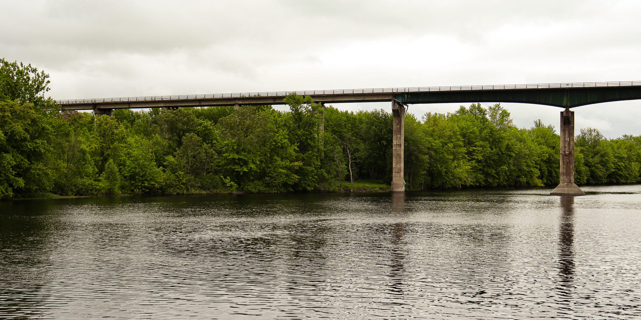
Today there is little to find at the site to identify it as a former wharf. This lack of physical remains is in large part why I am so taken by the Upper Jemseg Wharf. As the recent CBC coverage has emphasized, the Jemseg River has been a nexus point for travel through New Brunswick since time immemorial. There was a time when the steamboats were as vital to the movement of people and goods through the Province as the TransCanada is today, but at least at Upper Jemseg, the physical reminders of this history have been wiped clean. I have only managed to piece together a mental image of Upper Jemseg because the wharf happened to be a great location to take photos of the aforementioned Jemseg bridges. The wharf is never the subject of these photos, but there are enough fragments caught in the foreground to infer a picture of the wharf. This fragmentary evidence makes the wharf all the more tantalizing, as it remains just out of reach.
Sam Farley, “Jemseg, the nexus point of New Brunswick, CBC News, July 14, 2024, https://www.cbc.ca/news/canada/new-brunswick/jemseg-history-bridges-nexus-point-1.7262617.
James Upham and Khalil Aktar, “Roadside History takes us to the Jemseg River,” July 11, 2024, in Information Morning - Saint John, produced by CBC Radio One, podcast, 13:50, https://www.cbc.ca/listen/live-radio/1-28-information-morning-saint-john/clip/16080792-roadside-history-takes-jemseg-river, 08:21-08:28; “There was a steamboat wharf just over there and we have, you know, all kinds of records of people spending time at that wharf.”
Canadian Hydrographic Service, Sailing Directions for the Saint John River from Saint John Harbour to Fredericton and Kennebecasis Bay (Ottawa: Canadian Hydrographic Service, 1934), 55; Canadian Hydrographic Service, Saint John River Pilot from Saint John Harbour to Fredericton with Grand Lake and Kennebecasis Bay (Ottawa: Canadian Hydrographic Service, 1965), 36.
Canadian Hydrographic Service, Small Craft Guide Saint John River, 1st ed. (Ottawa, Ontario: Department of the Environment, 1976), 61.
Canadian Hydrographic Service, Small Craft Guide Saint John River, 1st ed., 63.
Although most details here are derived from the limited photographic evidence available, the presence of a small craft access staircase “that went down the middle of the side of the low water wharf into the water” was confirmed through correspondence with a former area resident in the Facebook group, New Brunswick Upon Days Faded on July 23, 2024.
Twenty-Seventh Annual Report of the Chief Commissioner of Public Works in Journal of the House of Assembly of the Province of New Brunswick (Shediac, New Brunswick: Le Montieur Acadien Steam Press, 1881), 6 (638); Twenty-Eighth Annual Report of the Chief Commissioner of Public Works in Journal of the House of Assembly of the Province of New Brunswick (Fredericton, New Brunswick: H. A. Cropley, 1882), 6 (642).
Canadian Hydrographic Service, Sailing Direction, ATL 107 - Saint John River, 2nd ed. (Ottawa, Ontario: Fisheries and Oceans Canada, 2022), 5-1.
Fifty-First Annual Report of the Chief Commissioner of Public Works in Journal of the House of Assembly of the Province of New Brunswick (Fredericton, New Brunswick: Anslow Bros, 1905), 38; Report of the Minister of Public Works on the Works Under his Control for the Fiscal Year Ended March 31, 1908 — Chief Engineer’s Report in Sessional Papers of the Fifth Session of the Eighth Parliament of the Dominion of Canada Volume 9 (Ottawa, Ontario: S.E. Dawson, Printer to the King’s Most Excellent Majesty, 1908), 96.
NB Public Works 1906, 141; Information derived from extract provided by the Legislative Library so I don’t have the full citation.
Report of the Minister of Public Works on the Works Under his Control for the Fiscal Year Ended March 31, 1926 — Chief Engineer’s Report in Annual Departmental Reports 1925-26 Volume 4 (Ottawa, Ontario: F. A. Acland, Printer to the King’s Most Excellent Majesty, 1927), 42.
Peter Cronk Malmberg, Steam Transportation on the Saint John River 1816-1946 (Fredericton, New Brunswick: University of New Brunswick, 1990), 59.
Susan Blair (ed.), Wolastoqiyik Ajemseg, The People of the Beautiful River at Jemseg: Volume 2, Archaeological Results, (Fredericton, New Brunswick: New Brunswick Culture and Sport Secretariat, 2004), https://www2.gnb.ca/content/dam/gnb/Departments/thc-tpc/pdf/Arch/MIA36english.pdf, 280.
Norman W. Smythe and Joey Garnett, “Call for Expressions of Interest: Upper Jemseg Wharf,” Telegraph Journal, July 20, 1996, https://da.tj.news/viewer?opub=New_Brunswick_Telegraph_Journal&date=19980720&page=22&search=upper jemseg&filename=9412_NBTJ_1998-1999; C6; Tracey Cole, “Wharfs are up for grabs,” Daily Gleaner, August 6, 1998, https://da.tj.news/viewer?opub=Daily_Gleaner&date=19980806&page=10&search=upper jemseg&filename=0170_DG_A40049, B2.
Gabe Hrynick, Ken Holyoke, and Susan Blair, “Great Sites: Jemseg, ‘Inconclusive,’” Feburary 9, 2024, in The New Brunswick Archaeology Podcast, podcast, 1:41:03, https://rss.com/podcasts/nbarchaeology/1337859/, 0:49:20-0:49:57.