

Carter's Point Wharf
Carter’s Point Wharf is a dilapidated, split-level high and low water wharf on the Long Reach of the Lower Wolastoq.

Carter’s Point Wharf is 13 meters wide and approximately 40 meters long, although it is difficult to determine how far out the deck originally extended because the wharf has been so badly damaged over the years. Despite its relatively slender frame, Carter’s Point was a high and low water wharf, incorporating a split level design with a thin high water section surrounded by a larger low water section.
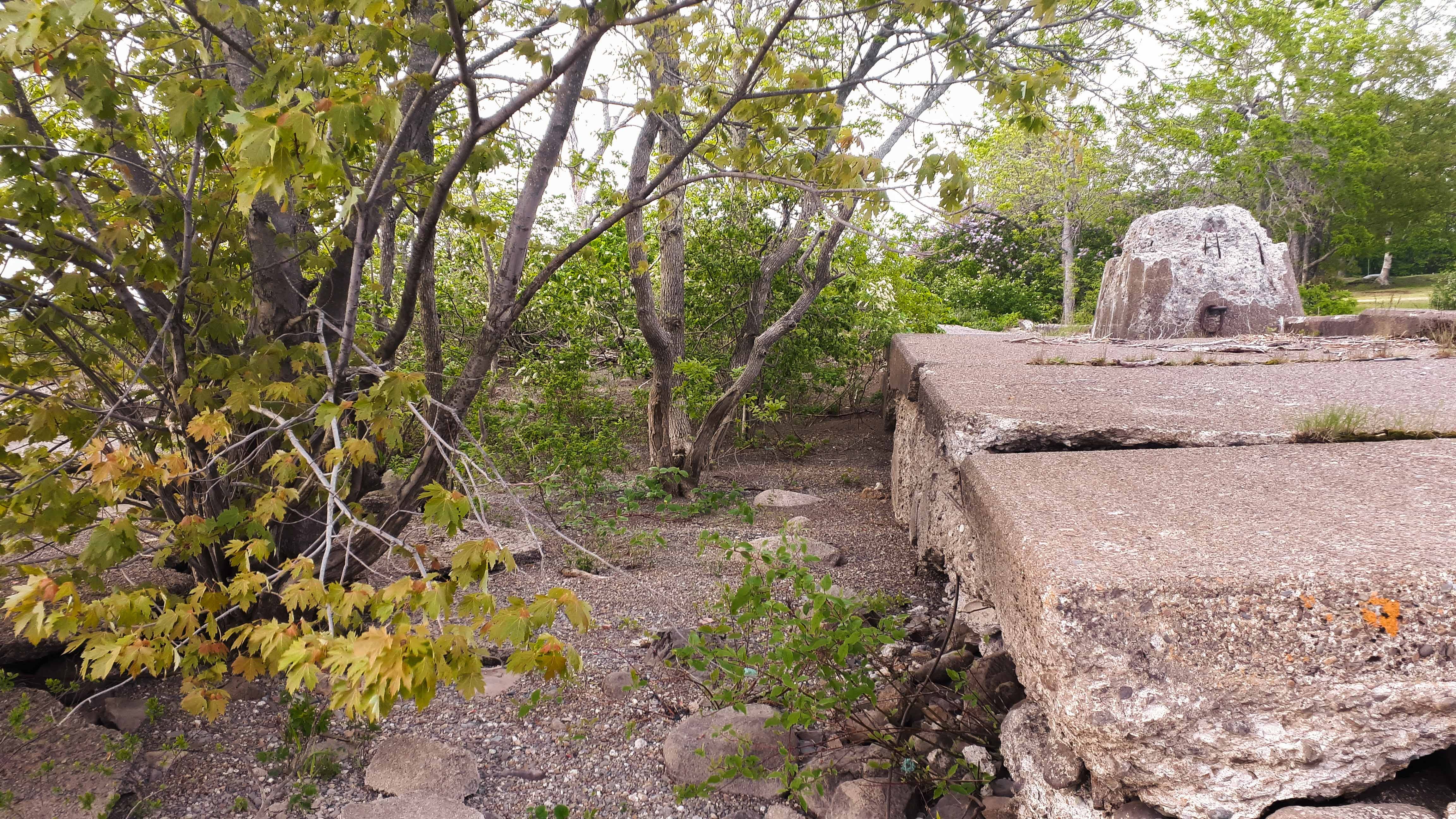
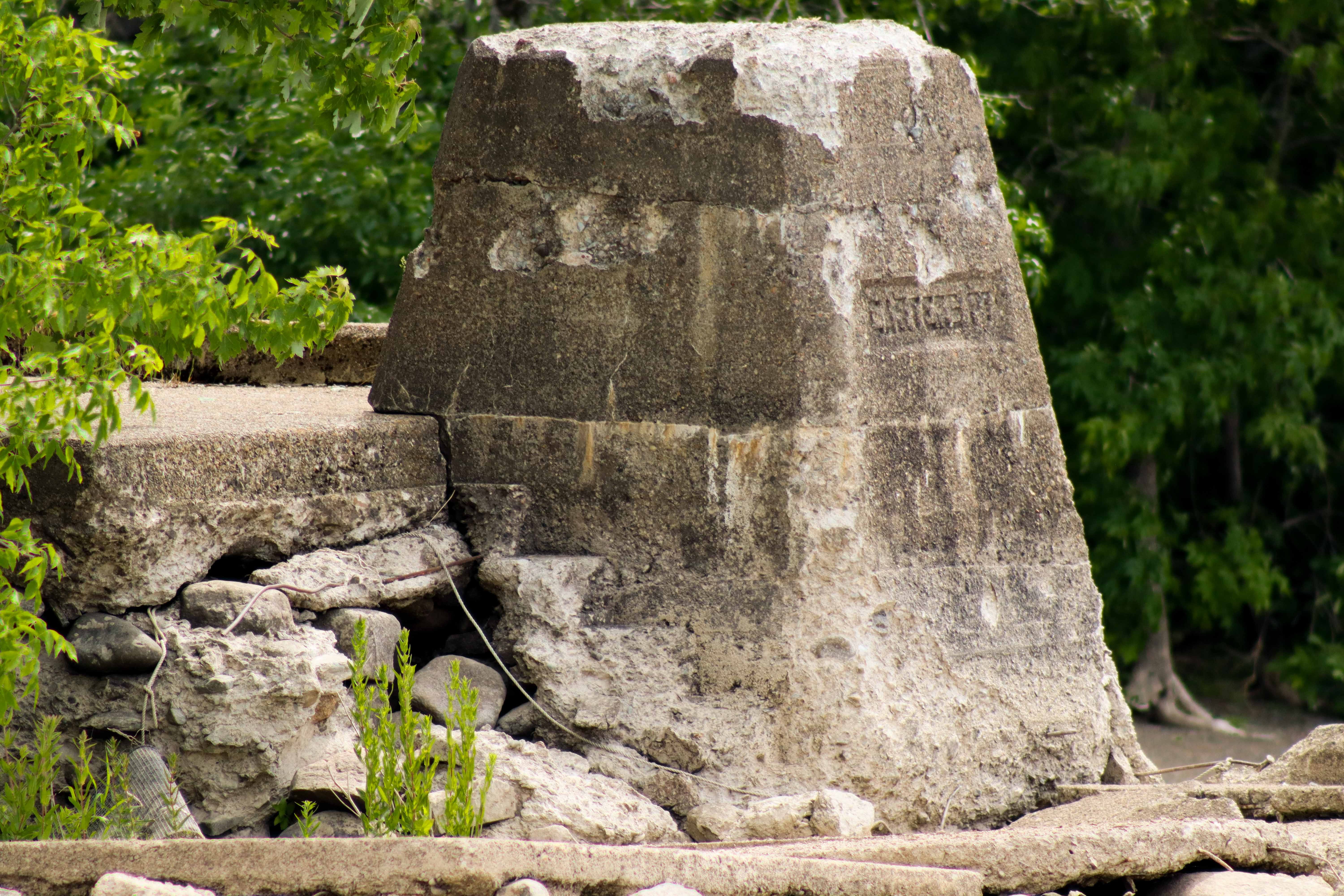
Most of the low water deck, which once extended past the high water section in an L-shape, has been reduced to loose ballast stones and cracked concrete over the years. The wharf face has been entirely destroyed. Originally, the wharf face would have been composed of a pair of twin corner piers and a cargo slip.12 One of the corner piers has been toppled on its side but is still a prominent feature given its size. The other pier has disappeared entirely, likely dislodged and broken up by an ice flow or spring freshet.
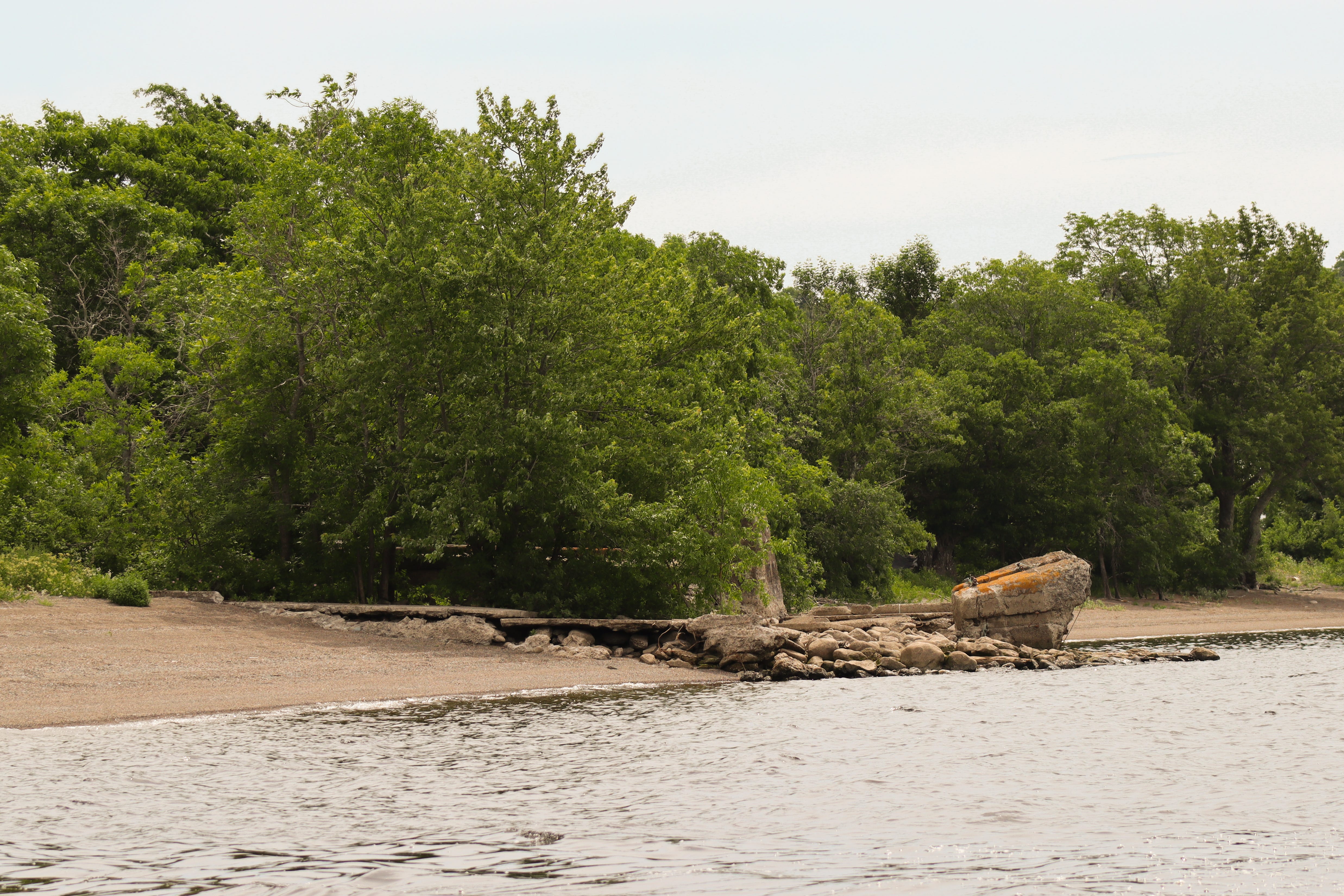
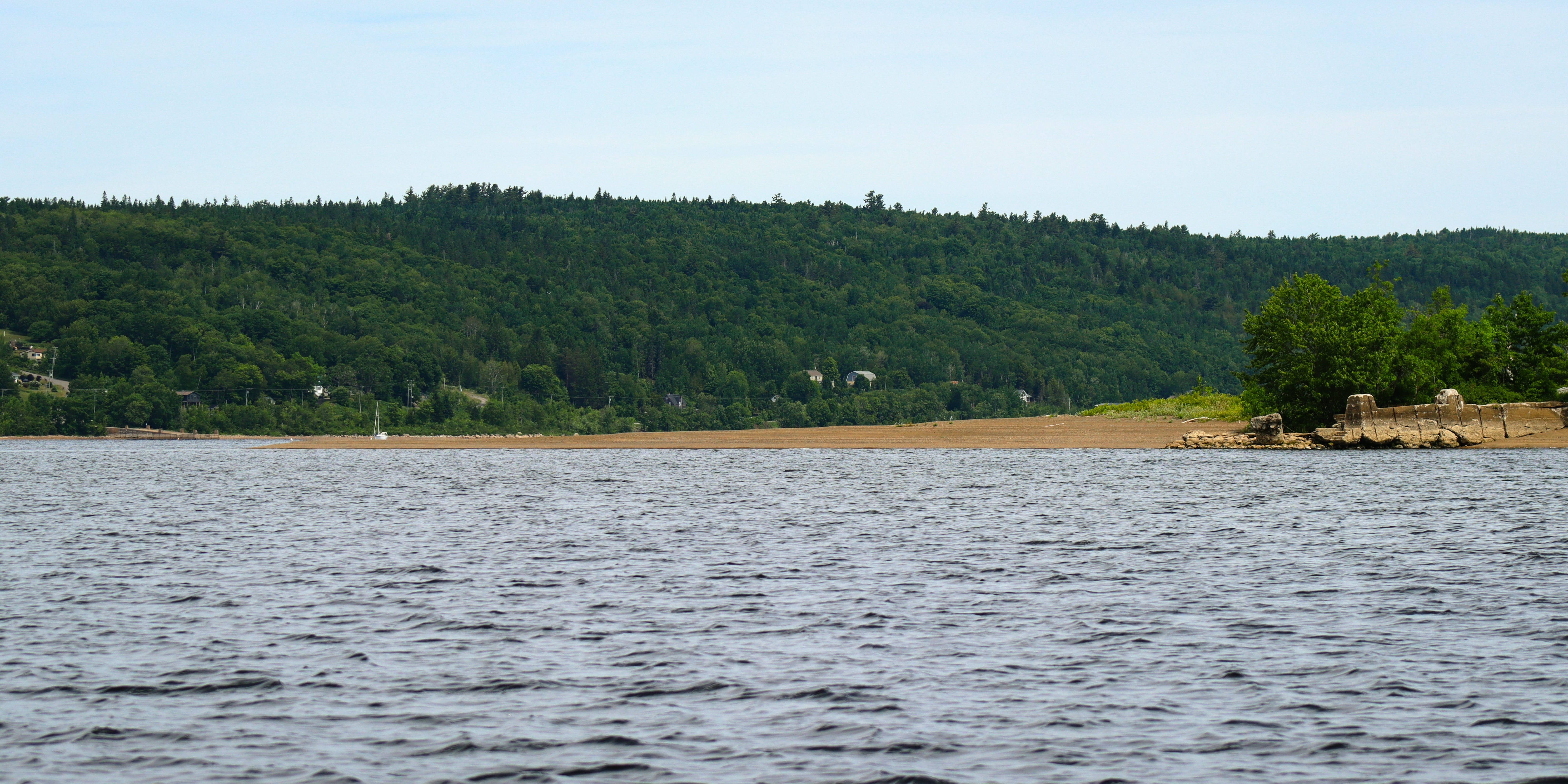
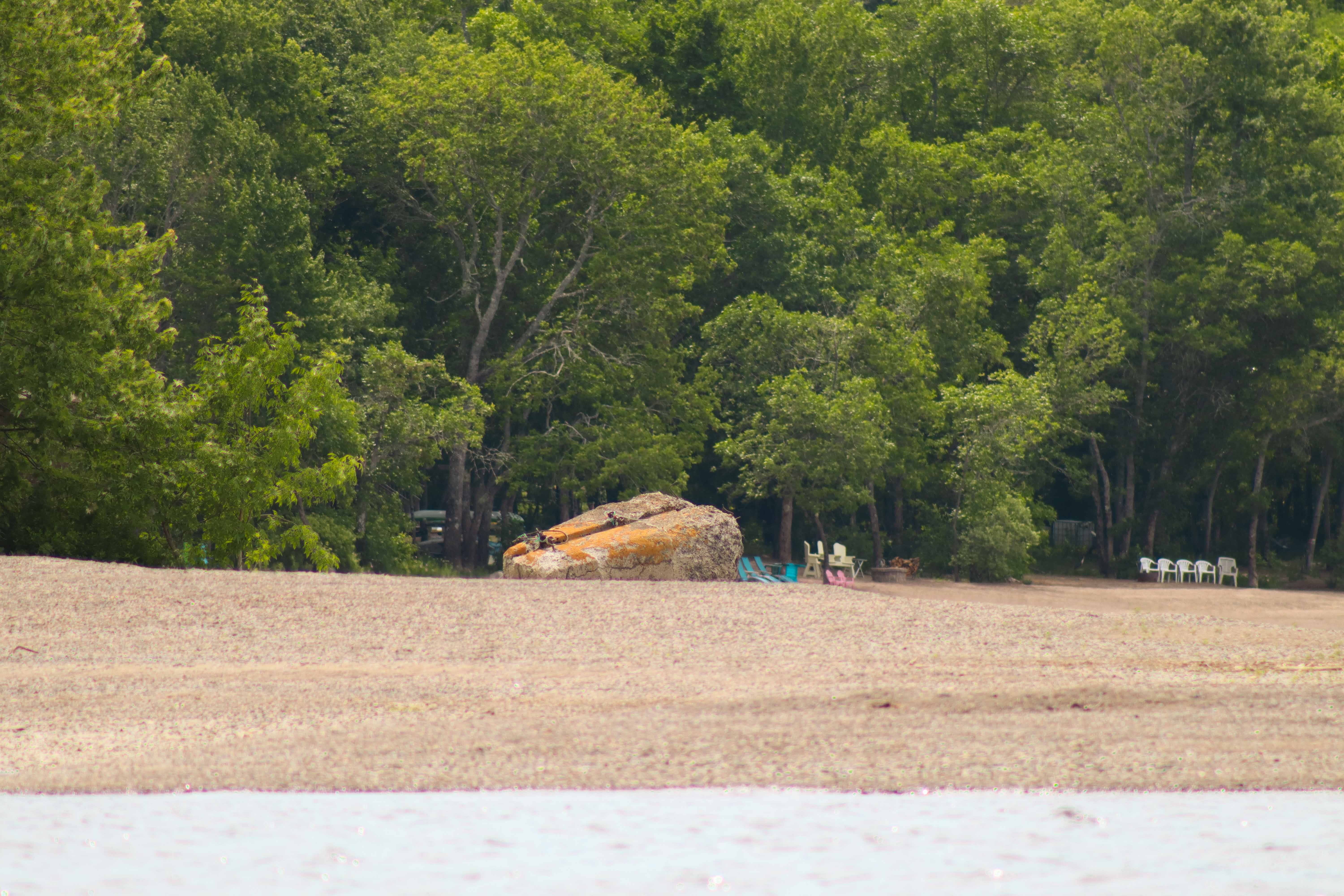
The portion of the low water deck that runs parallel to the high water section has retained more of its structural integrity but has become quite overgrown. Most of the exposed ballast has been filled in by the shifting gravel of the point and a spine of maple and ash trees now runs up through the centre of the deck. Their canopy extends over most of the wharf, making it appear quite small when viewed from the north.
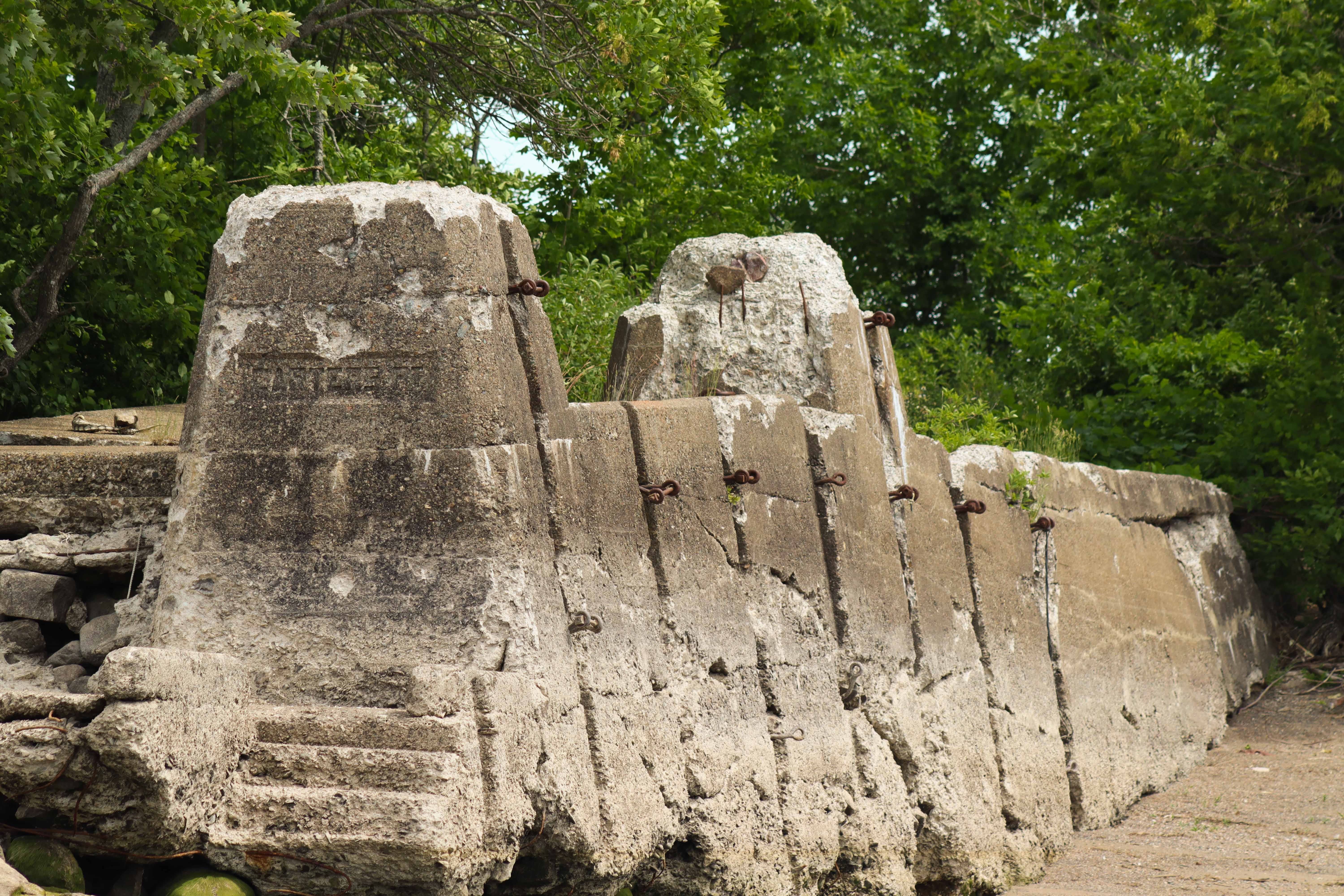
The high water section consists of a narrow sidewalk with two inset piers along the south-facing wall. Grooves for wood fender posts are present along most of the wall’s length, although no posts have actually survived to the present. The front corner pier features an inscription reading Carter’s Pt. and was formerly attached to a staircase which connected the high water deck to the rest of the wharf. These stairs have deteriorated beyond recognition, but their silhouette can still be seen on the northern face of the pier. The remnants of a second staircase just below the pier indicate that there was also a small craft access point included in the wharf’s original design.
Carter’s Point is one of a number of sandy spits found along the Long Reach - a relatively open and straight section of the Wolastoq along the Kingston Peninsula that runs parallel to the Kennebecasis River. The deposition bar at Carter’s Point extends 100 meters or so into the river, but its position on the headland of the eastern side of Carter’s Cove make it appear about half a kilometer larger when approaching from downriver. The bar is also quite tall. Although the Carter’s Point Wharf is the nearest neighbour to Public Landing Wharf across the river in Greenwich Parish, the structure is entirely obscured by its eponymous point when viewed from the deck of Public Landing.
Prior to the establishment of the cable ferry system, the small community around Carter’s Point depended on the river as the primary means of transportation to and from Saint John. Although a bridge across the Kennebecasis River to the mainland was accessible at Hampton, the 45 kilometer journey from Carter’s Point up the Kingston Peninsula to the bridge made the steamboats a far more attractive alternative for travel and trade.3
The Carter’s Point Wharf was built in 1905 to secure reliable service from the steamboats traveling between Saint John and Fredericton.4 Despite the community’s need for a connection with the outside world, there were clear navigational challenges associated with erecting a steamboat wharf on a sandy point like Carter’s. Because of its peculiar location and perpendicular orientation, the wharf was only ever accessible to smaller steamers like the Oconee, Majestic, and Champlain.5
There are multiple recorded instances of boats getting stuck on the point when attempting to stop at the wharf. Robert M. Wood recalls one incident when the Majestic ran full tilt into the gravel bar of the point after a night-time stop at the wharf and remained grounded there for several hours.6 The Champlain suffered a similar indignity on a gusty day in 1914 when a sudden lull in the wind failed to carry the ship far enough away from the point as it departed the wharf, leaving the Champlain grounded just above the wharf on the point until the high tide.7
Given its inconvenient position, it is possible that Carter’s Point Wharf was not deemed an especially high priority for repairs — especially after the end of steamer service in the 1940s. Although the wharf was upgraded with concrete sometime after 1930 and reported to be in good condition in 1934,8 by 1965 the wharf had been declared “unfit for use.”9 The following year, the federal government placed Carter’s Point Wharf on a list of former steamboat wharves to be disposed of and potentially returned to the provincial government.10 Writing in 1969, Robert M. Wood notes that “an occasional motor-boat might call here but the wharf is almost a ruin.”11
At some point after this, the wharf was sold a private owner.12 It is unclear to me whether the federal government made this sale directly or if the wharf was transfered to the province for a time before ultimately being sold. Since the wharf was disposed of prior to the 1990s, it was not subject to the Small Craft Harbour divestiture process and was not offered to a community group like the St. John River Society. The approach road was barricaded sometime between 1965 and 1976 and no public boat launch is accessible nearby.13
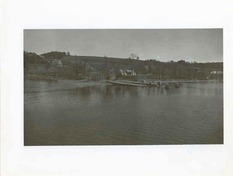
John L. Lackhead, Photograph of “Carter’s Point, Saint John River, New Brunswick”, 9 September 1937, 1989.55.2, Photographic Database, New Brunswick Museum; I have had a difficult time finding images of the Carter’s Point Wharf that are clear enough to piece together exactly what the wharf face looked like when intact. This image is the clearest I’ve found, and although it confirms that there were once two corner piers at the wharf face, since it was taken during the freshet the water is too high to identify any other defining features.
A. F. Belding, Technical drawing depicting wharf property known as Carter’s Point Wharf attached to federal Order-In-Council No. 1923-2196, 27 October 1913, RG2M 71/5705, item 2955, Privy Council Office Fonds, Library and Archives Canada, Ottawa, Ontario; The presence of a cargo slip on the concrete iteration of Carter’s Point Wharf is admittedly conjecture on my part, but given that a cargo slip was included in the wooden iteration of the wharf in 1919, it is reasonable to assume this feature would have been retained when the wharf was upgraded with concrete in the 1930s.
Robert M. Wood, “River Boats and Reveries” (Unpublished material, 1969), 1. “Today, when almost everything moves on wheels, few of the younger people have much an idea of what an important part boats, of one kind or another, played in the earlier days, especially in a place like Carter’s Point, situated well down on the tongue of land between the Kennebecasis and Saint John rivers with the nearest bridge at Hampton some twenty-eight miles away.”
Robert M. Wood, “River Boats and Reveries,” 4-5; “At Carter’s Point, before it had a wharf, and at many other placed on the lower part of the river passengers and light freight were put aboard or taken off the steamer by means of a row boat. … The steam-boat companies would engage a local man to ‘tend the boats.’ When passgers were to go aboard the boat was rowed well out to deep water. … If passengers were to land the steamer’s whistle notified the boat-tender in time for him to row out to recieve them without delay. … Now and then someone got splashed a bit but I do not remeber any fatal accidents.”
Robert M. Wood, “River Boats and Reveries,” 7.
Robert M. Wood, “River Boats and Reveries,” 7.
Donald Taylor, From the Splash of the Paddle-Wheel: True Tales of the Steamboat Era (St. Stephen: Print N’ Press Limited, 1985), 87.
Canadian Hydrographic Service, Sailing Directions for the Saint John River from Saint John Harbour to Fredericton and Kennebecasis Bay (Ottawa: Canadian Hydrographic Service, 1934), 39.
Canadian Hydrographic Service, Saint John River Pilot from Saint John Harbour to Fredericton with Grand Lake and Kennebecasis Bay (Ottawa: Canadian Hydrographic Service, 1965), 21.
Correspondence from D. I. Higgins to T. J. Stephen, 6 December 1966, RG12, Accession number: 1986-87/016 GAD, Box number: 1, File number: 9664-106, Library and Archives Canada, Ottawa, Ontario.
Robert M. Wood, “River Boats and Reveries,” 7.
Based on a corespondence with a former resident.
Canadian Hydrographic Service, Small Craft Guide Saint John River, 1st ed. (Ottawa: Department of the Environment, 1976), 41; “The wharf here is unfit for use and the approach road is barricaded.”
I do hope carters point wharf gets a new breathe of life to its boaters and community once again to enjoy the greatest river in New brunswick